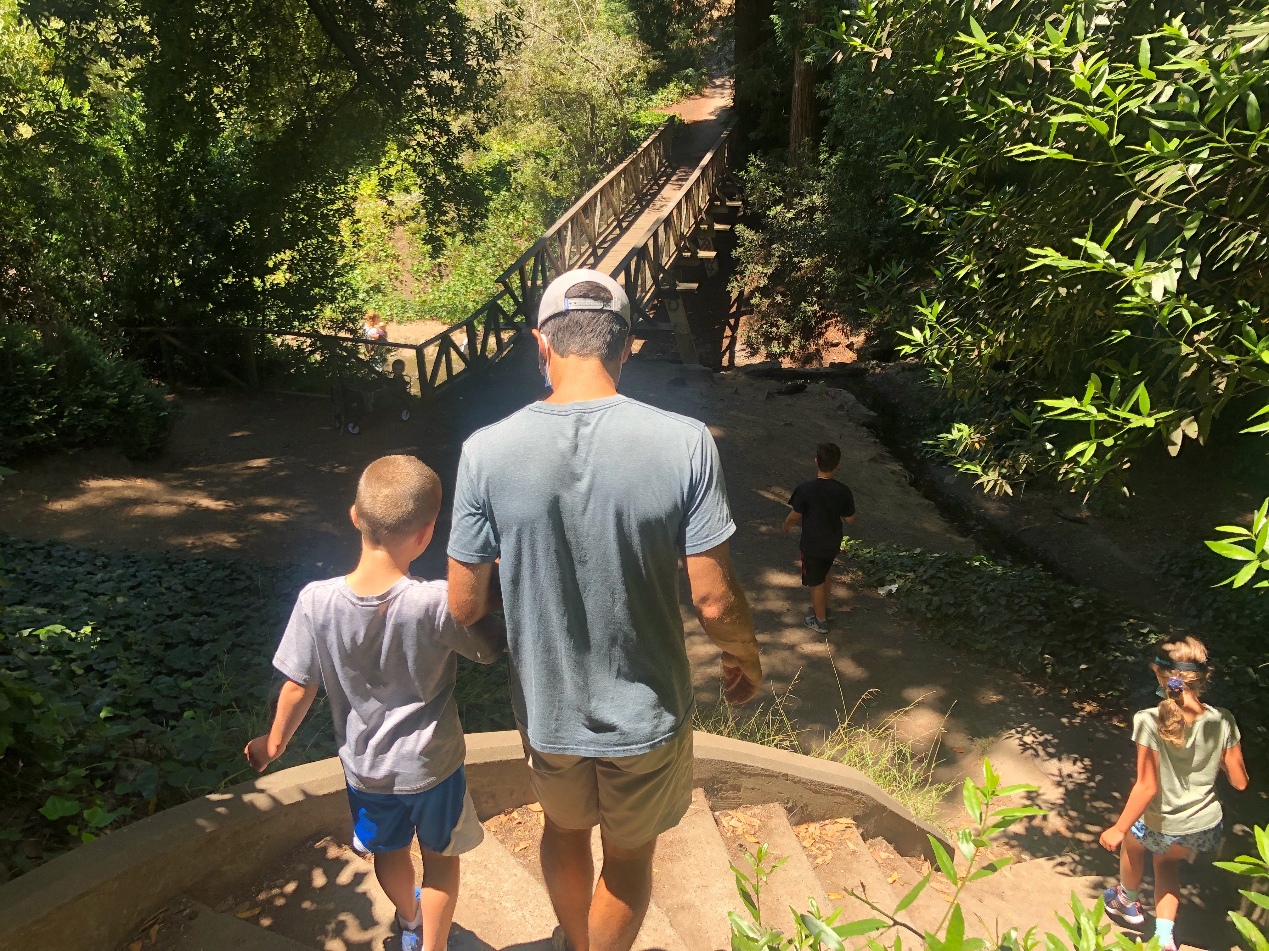
It’s the rainy season, so hiking on dirt or tree covered trails can be a muddy mess! Here are three hikes along city roads and through secret and not-so-secret staircases that avoid the mud. We love urban hikes, but there are a lot of stairs involved in these, so they may not be for everyone. There are no sign posts for any of these hikes – you’ll need to bring a map and follow the street signs, or follow the directions below! I usually pull out my phone, and have Google Maps ready for these. If you zoom in on Google Maps, you’ll see all of the local staircases and can really make these hikes your own.
San Francisco: Crosstown Trail Section 3 Stair Loop Hike
Part of this hike is a section of the much longer San Francisco Crosstown Trail. (I will have future blog posts on the other sections of the Crosstown Trail – it really is a wonderful trek through the city!) This stair hike takes you through the neighborhoods of Forest Hill and Inner Sunset. You’ll get views of the ocean and panoramic views of the city on this hike! This hike is approximately 4.5 – 5 miles roundtrip.
This starts near the Forest Hill MUNI Station. We parked on the street near 20 Woodside Avenue, and walked north on Laguna Honda Boulevard, crossing the street at the crosswalk in front of Laguna Honda Hospital to Forest Hill Muni. We then followed the Crosstown Trail’s directions for Section 3:
- Walk up greenway on north side of station.
- Turn left at Magellan sidewalk and walk one block to intersection of Pacheco.
- Cross to other side and continue to follow Magellan.
- Ascend the Pacheco Stairs that are located just past #298 Magellan. (Note: This is called “Path St” on Google Maps.)
- At top of stairs, turn left on Castenada. Follow Castenada, first past Lopez and then past pole marked with street signs for San Marcos and Santa Rita.
- About 20 yards further on the right you will see two yellow signs (“Narrow Street Trucks” and “Not a Through Street”.) Walk up this “no through” street and a few yards later, ascend stairs embedded in a concrete wall on your right. Bear left as you ascend.
- At top of stairs, turn left on San Marcos. Proceed to 200 San Marcos and turn right up stairs. At the top of stairs, turn left on 9th Avenue.
- Turn right at 12th Avenue.
- Turn left on Quintara.
- Turn right on 14th Avenue and walk along eastern (uphill) sidewalk.
- Cross Radio Terrace and continue on 14th Avenue past Pacheco.
- At Noriega, bear right and continue along 14th Avenue.
- Continue past “Do Not Enter” sign.
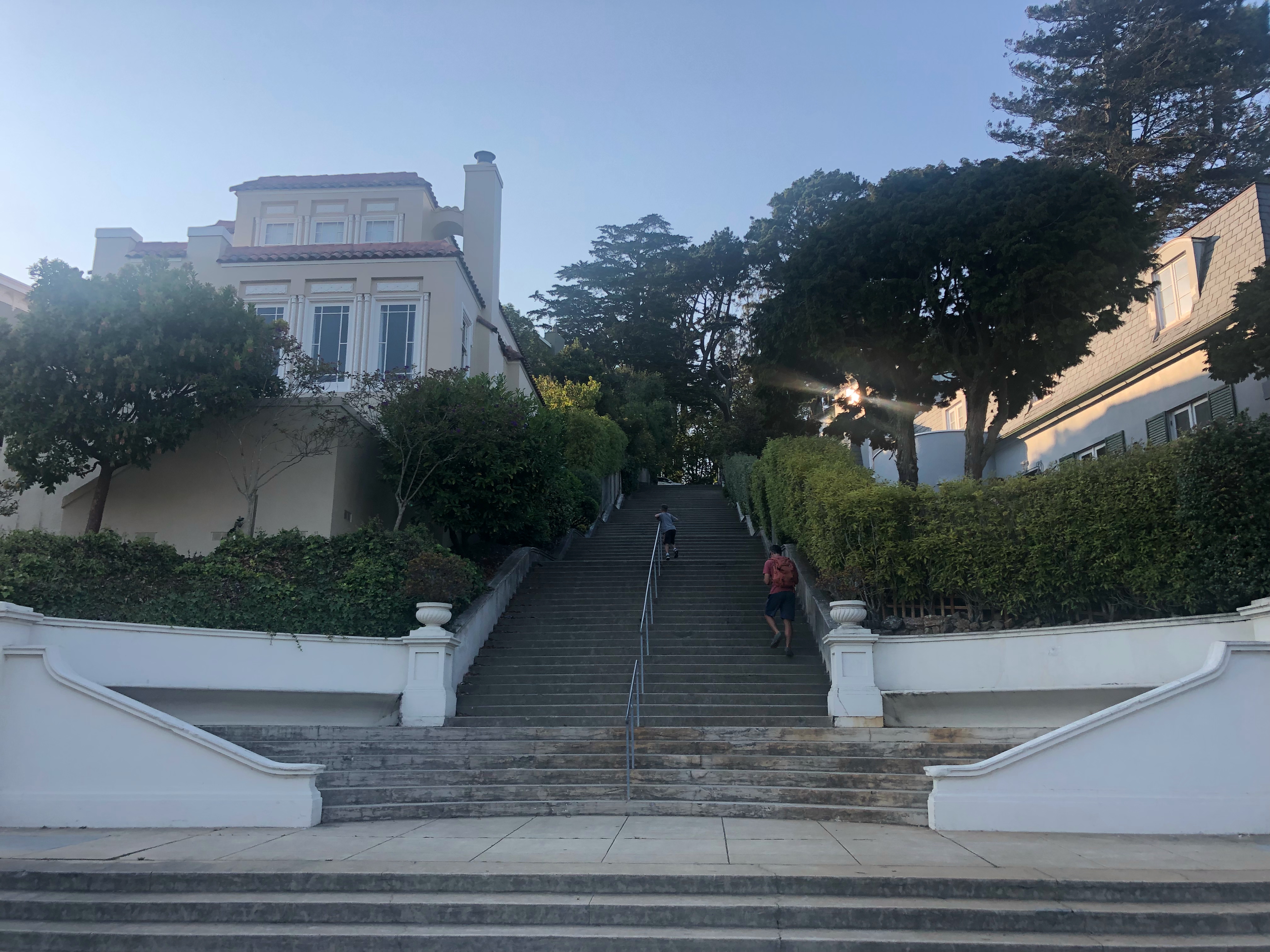
- Enter Grand View Park by ascending Moraga Stairs.
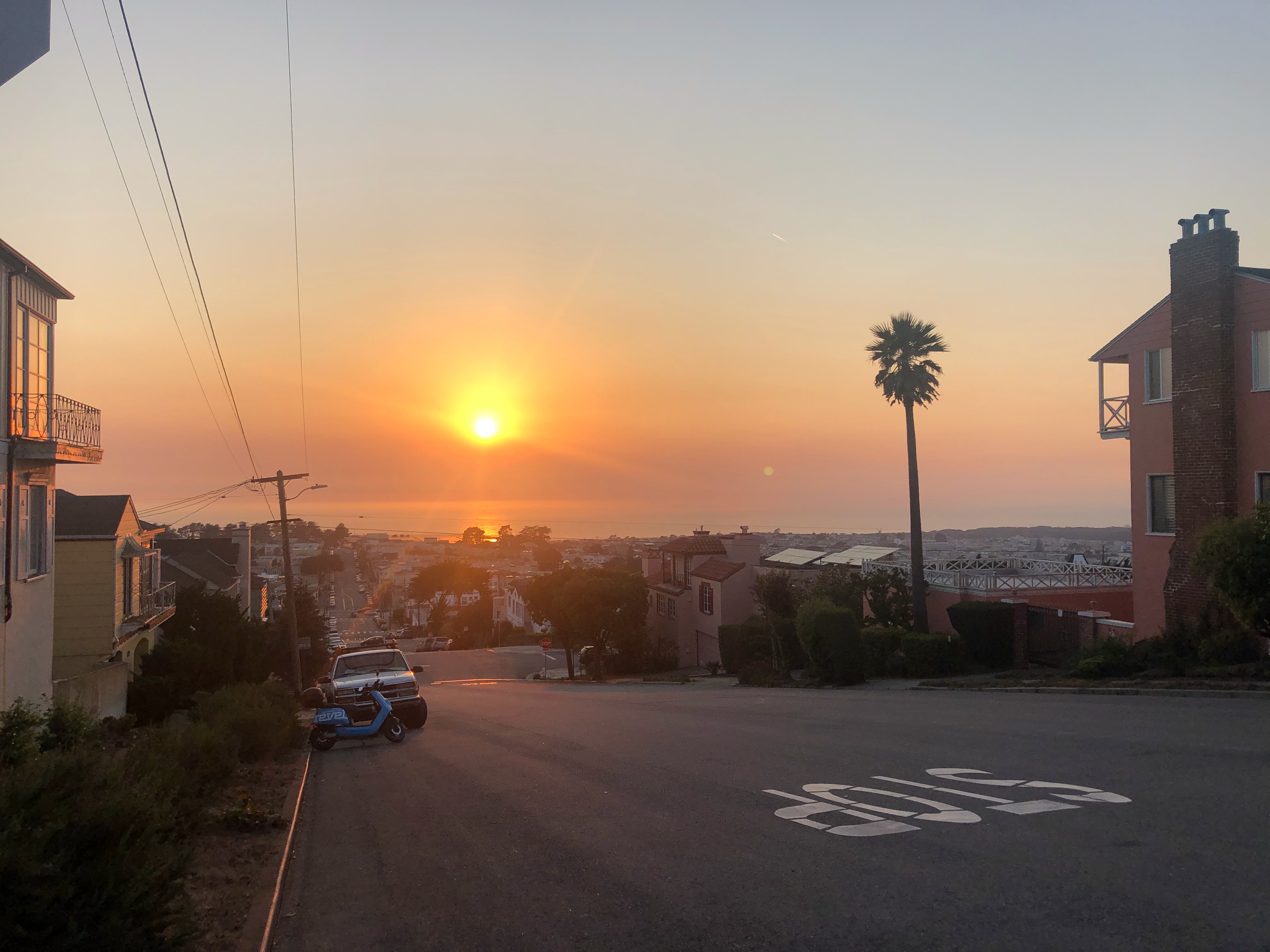
- At top of stairs follow path on the left. (Before you reach the descending stairs on the west side, be sure to walk to the right a couple of yards to get a 360-degree view of the city. NOTE: This is a really beautiful spot to take a break!
- Descend the stairs on the west side.
- Turn right at the bottom of the stairs, walk about 50 yards, and descend stairs embedded in concrete wall on left.
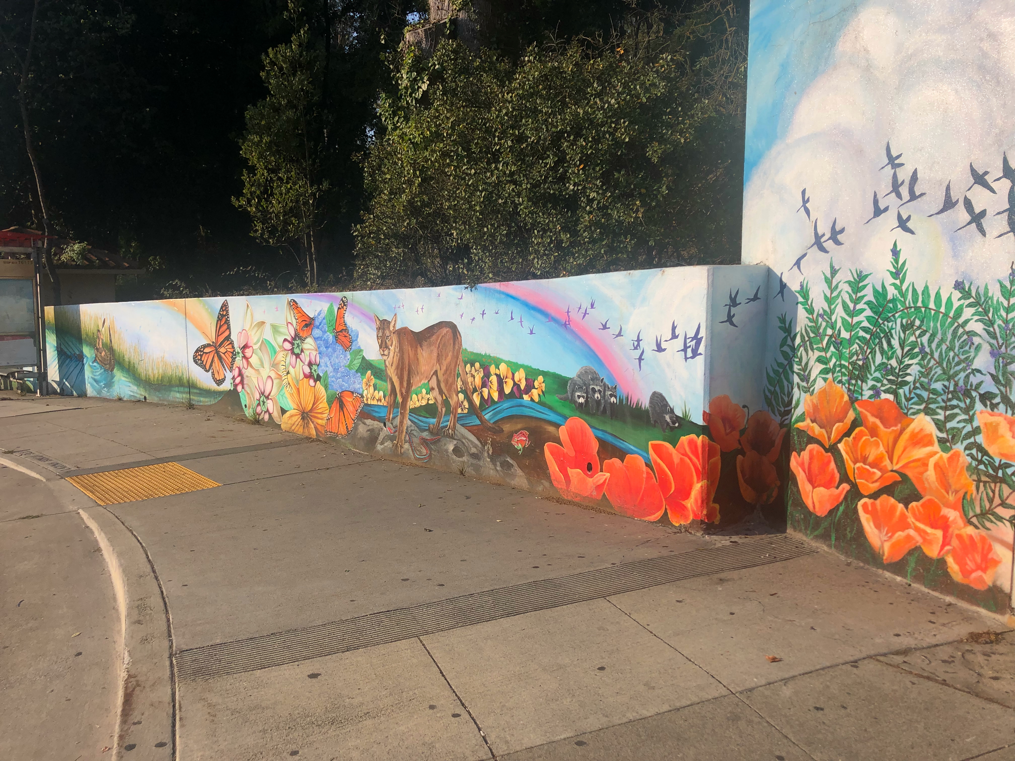
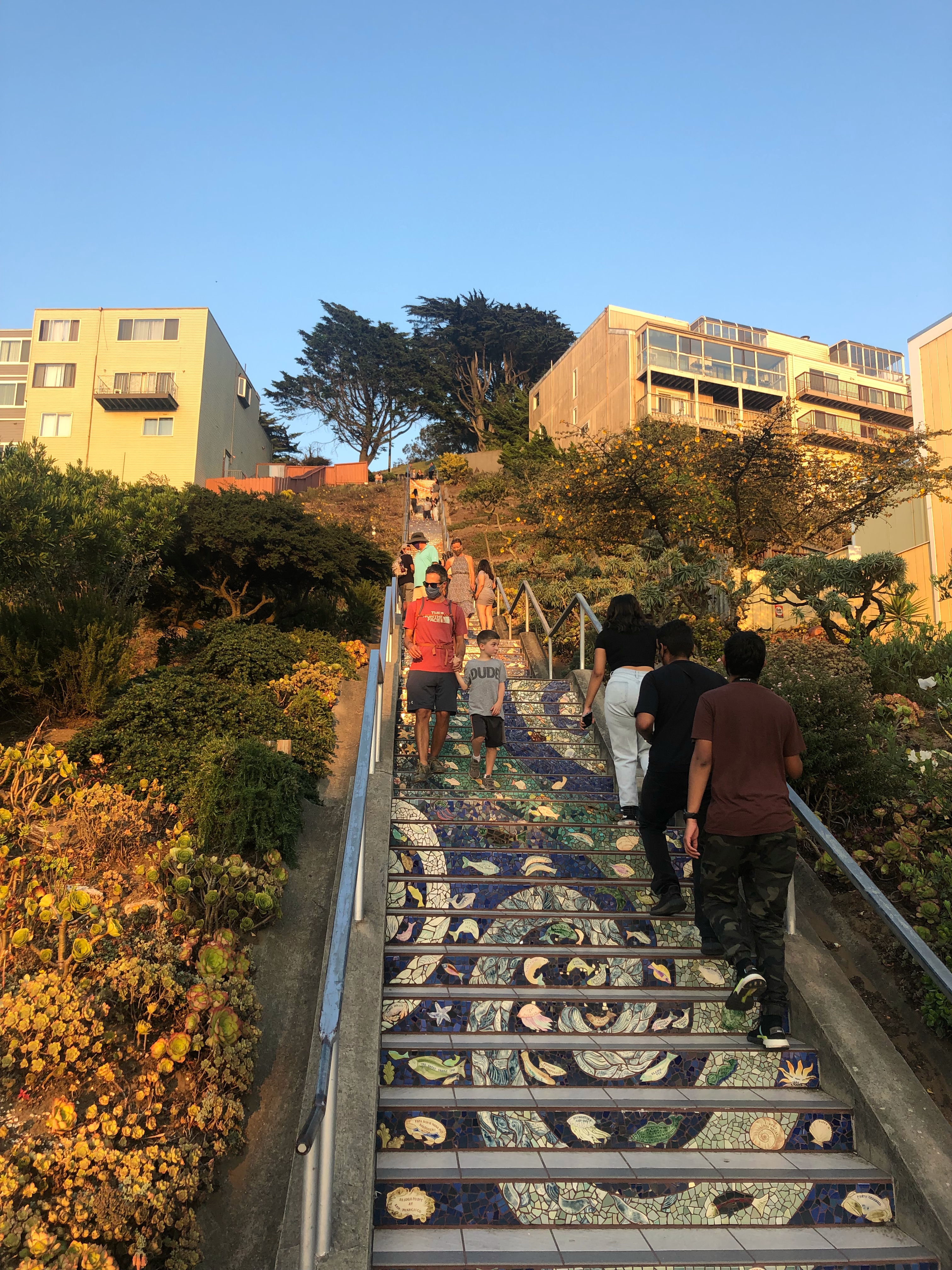
- At bottom of stairs, proceed straight down hill about 50 yards and descend 16th Avenue Tiled Steps (the Mosaic Stairway) on your left. (When descending, be sure to turn around to observe the beautiful artistic tiles.)
This is where we turned around. You can do this as an out-and-back and simply retrace your steps back to your car. We made it a loop hike, making the return easier than the way we came. We turned left on 16th Street and walked until we reached Quintara Street. We turned left onto Quintara, and proceeded up the steps. We continued along Quintara until we turned right onto 12th Street. Follow 12th Street until you turn left onto 9th Street. Follow 9th Street until you reach the stairs on your right. Take those down and through San Marcos all the way down to Castaneda (you should recognize these from the start of the hike!). Turn left on Castaneda, then right onto San Marcos. From San Marcos, bear left onto Dorantes Avenue and then left onto Magellan Avenue shortly after. Magellan Avenue will take you back to the path behind the Forest Hill MUNI.

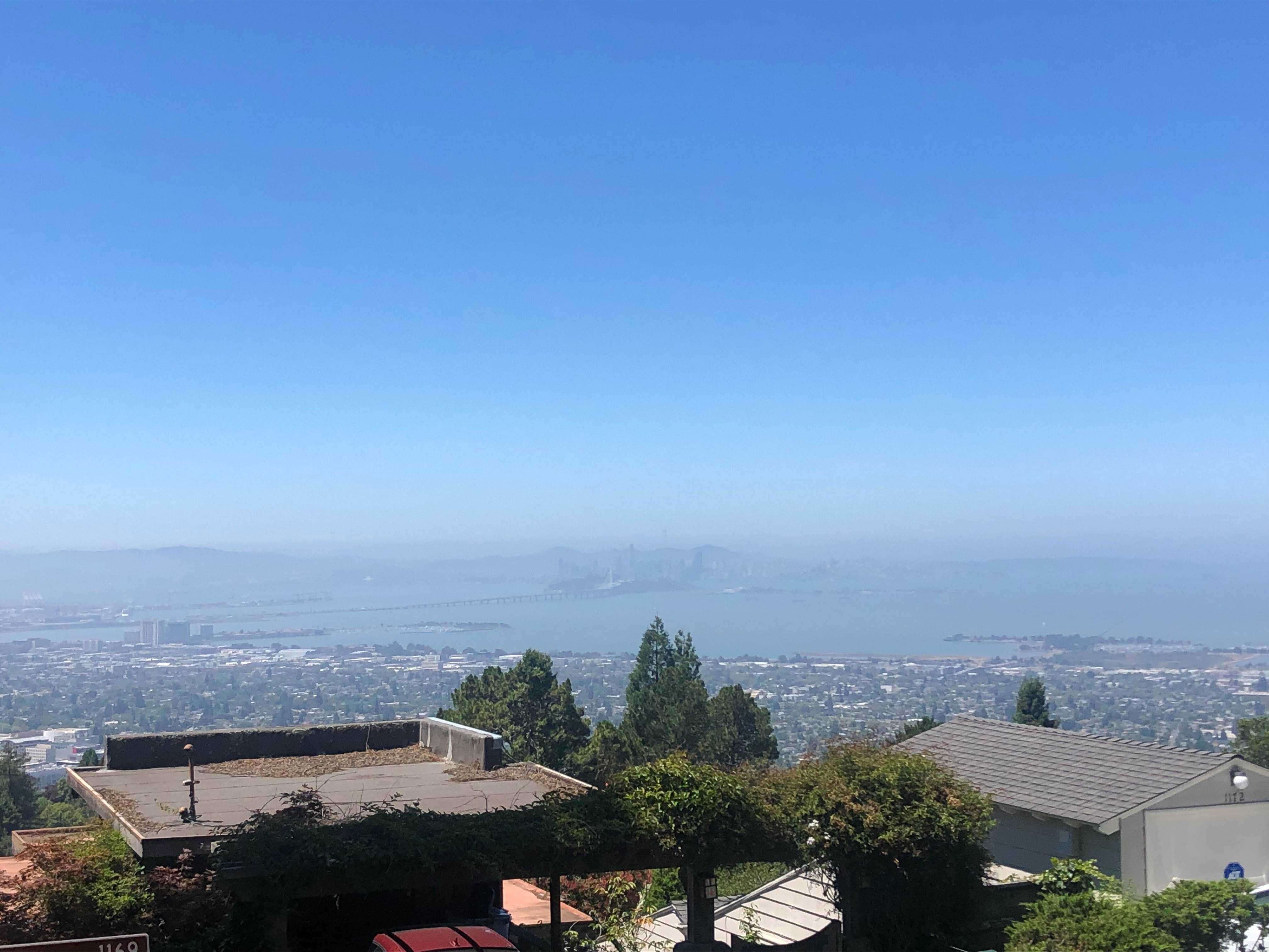
Berkeley: Stair Loop from Codornices Park
This stair walk in the Berkeley Hills is just over 2 miles round trip. We found street parking on Euclid Avenue across from the Berkley Rose Garden. There is a parking time limit on the streets here, so pay attention to where you park! This hike starts at the north end of Codornices Park (which has a great concrete slide for kids!) on the Tamalpais Path. Take the path out of the park and up the stairs. At Tamalpais Road, turn left and continue up until Shasta Road. Turn left on Shasta, and continue to Keith Avenue. At Keith, turn left. Continue briefly up Keith, and take the Covert Path on the right side of the Road all the way up to Keeler Avenue (you’ll pass through Cragmont Avenue). At Keeler, hang right and then take a left up Whitaker Path up to Sterling Avenue. Turn right onto Sterling, and follow it until you reach Shasta Path on your left (you will pass by the Stephenson Path stairs on your way). Head up Shasta Path, and take a right when you reach Shasta Road. Walk along Shasta Road, until you reach Tilden Path on your left. Take Tilden Path to Grizzly Peak Boulevard. Turn left on Grizzley Peak, heading up the hill (past Shasta Road) to reach Stoddard Path stairs on your left. Stoddard will take you down to Miller Avenue. On Miller, take a right and then take the Stephenson Path stairs on the left. Head down the Stephenson Path, through Sterling Avenue, down to Keeler Avenue. Turn left on Keeler, and walk until you reach Shasta Road on the right. Turn right onto Shasta Road and follow Shasta back to Tamalpais Road, then back down the Tamalpais Path stairs to your car. Hat tip: Weekend Sherpa.


Oakland: Claremont Path to Arollo Path Stair Loop
There are so many stairways in Oakland! We hiked this route just last week, and it was just under 2.5 miles. We park on Brookside Drive, using 6245 Brookside Drive, Oakland as a guide. Head up the Claremont Path stairs near this address. Turn right on Ocean View, pass Margarido Drive, and find the Ridgeview Path stairs on the left. Head down the Ridgeview Path stairs. Continue straight on Rockridge Place Road, and then up the stairs at the end of the street to arrive at Margarido Drive. Turn right and then make a quick left to continue on Margarido Drive. Follow Margarido to Acacia Avenue and turn left. Walk along Acacia Avenue, pass Manchester Drive, and turn down the Verona Path stairs on the right. Cross Mathieu Avenue and continue down Verona Path. Make a quick left and then right on Romany Road. Follow Romany all the way to Golden Gate Avenue and turn right. Walk along Golden Gate, which turns into Broadway Terrace, until you reach Arbon Path stairs on the left. Go all the way up to Contra Costa Road, crossing Buena Vista Avenue on the way up. Turn left onto Contra Costa Road, and continue – passing the Belap Path – until you reach the Chaumont Path on the left. Turn down the Chaumont Path stairs to Buena Vista Avenue. Turn Right onto Buena Vista, and walk until you reach the Arollo Path stairs on the left (you will pass the Gondo path on your way). Walk down the Arollo stairs to Golden Gate Avenue. Turn right and then left on Eustice Avenue. This will take you back to Brookside, and your car.
If you want a bonus staircase at the end of this – like my kids did – after taking the Arollo stairs down to Golden Gate Ave, rather than turning left onto Eustice, bear right up Buena Vista and take the stairs on the north side behind the concrete wall at the point where Buena Vista bends right, just before the intersection of Buena Vista Ave. and Buena Vista Place. Those stairs take you back down to Golden Gate Avenue, where you turn left and walk along the dirt path on the side of the road back to Eustice Avenue to Brookside.


